

Ahead of Storm Ciarán tracking across the south of the UK, a Met Office amber warning is in place for tomorrow (Thursday) for wind with speeds that could exceed 85mph in exposed coastal areas.
Impacts could include difficult driving conditions, disruption to transport, damaged or fallen trees and power outages.
Between today (Wednesday) and tomorrow, there are Met Office yellow weather warnings for both wind and rain. With downpours falling onto already saturated ground, there could be localised flooding.
A number of flood alerts are in place covering inland and coastal areas.
Kent County Council (KCC) will have additional highways officers available during the most severe weather and water pumps will also be on standby to deal with road drainage issues.
Drivers can keep up to date with the latest travel information by following https://twitter.com/KentHighways, on X (formerly Twitter) and can report issues on roads at www.kent.gov.uk/roads-and-
The Kent Resilience Forum (KRF), a group of organisations and agencies that plan and prepare as a unit for emergencies affecting the people of Kent, is taking guidance from the Met Office.
KRF’s Tactical Lead Toby Howe said: “Although with weather there is always a level of uncertainty, the Met Office has been very clear in its warnings, and we are working together to ensure that Kent is as prepared as it can be.
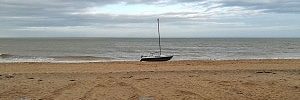
“We ask that residents keep up to date with the latest weather forecasts, travel information and advice and help the Coastguard by staying away from seafronts. It is not worth risking your life and others for that selfie.
“The real concern is the wind on Thursday. We are all remembering Storm Eunice and the impact it had on trees and power lines and so we are working closely with utilities to mitigate that. Because there are a lot of leaves on trees, that could cause a lot of problems in strong winds.”
The Environment Agency is asking people to stay away from piers, promenades and swollen rivers. People are also urged not to drive through a flood as just 30cm of flowing water is enough to sweep your car away.
People should check their flood risk, sign up for free flood warnings and stay across the latest situation at https://www.gov.uk/check-if-
UK Power Networks is monitoring the weather closely in regular contact with the Met Office. Its electricity network is built to be resilient but extreme weather can affect overhead power lines. People are urged to stay well clear of power lines and anyone spotting a damaged power line should report it immediately on 0800 31 63 105 (24-hour phoneline).
Additional UK Power Networks staff are on duty covering operational, technical and call centre roles, prioritising public safety and restoring supplies to customers as quickly and safely as possible. There is also free extra help to people living in vulnerable circumstances, who are on its Priority Services Register. For more information from UK Power Networks, visit: Storm Prepare (ukpowernetworks.co.uk)
More information:
Met Office news and advice: https://www.metoffice.gov.uk/
National Highways: Stay across its X feed for the latest on the road network through Kent – @HighwaysSEAST
Trains: There is the likelihood of cancellations and delays on Thursday, with a speed limit in operation. There will be no replacement bus services for cancelled train. Check before travel with the train company.
Crossing the channel: Ferries are likely to be cancelled so check with your operator before travel.
HM Coastguard: Advice here https://hmcoastguard.uk/coast and things to consider –
- Is it safe to go out at all? If there are weather warnings in place, it is best to stay in. Always adhere to official advice.
- Keep away from the water’s edge.
- Keep off groynes, piers, jetties and harbour walls. If you can feel the spray, you’re too close.
- Periods of intense rainfall make cliff edges more vulnerable. Stay far back from the edge and well away from the base of a cliff at all times, but particularly during or after heavy rainfall.
- Stay out of flood water. Remember that as little as 15cm (6 inches) of fast-moving floodwater can be enough to knock you off your feet.