


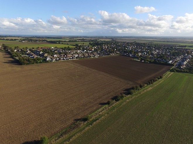
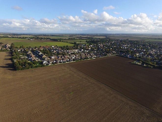
An application to build 214 houses on agricultural land in Minster will be discussed by councillors on Thanet’s planning committee.
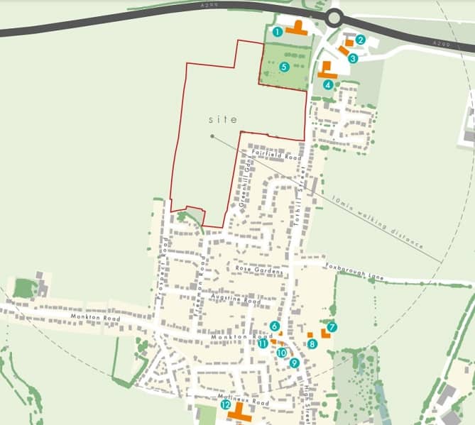
The total application area is 34.67 acres, with proposed residential development and associated open space and services on approximately 32.27 acres and a reserve site of 2.40 acres proposed for the future extension to Minster Cemetery.
The land on the west side of Tothill Street Minster is owned by St. John’s College Cambridge and Spanton Farms Limited.
The site is one of 12 parcels owned in the district by The Master, Fellows and Scholars of the College of St John the Evangelist in the University of Cambridge that have been put forward for development.
The site, which is on a Special Protection Zone, includes the expansion to the west of Minster cemetery.
Planning documents say: “The Tothill Street proposal provides an opportunity to provide much needed open market and affordable housing in the district. The scheme will provide a mix of tenure and type of dwellings which will offer benefit across a broad, cross section of social groups, including a proportion of affordable housing.
“Access to green spaces and leisure is an important ingredient to encourage social interaction of a community and sense of well-being. Formal and informal green open space is fully integrated into the scheme. It will also include formal areas for children’s play. “Enhancements to the existing landscaping such as the green corridor along the western boundary and sustainable drainage to create new opportunities for biodiversity within the development and surrounding area.”
The planning document also states: “The vision is to create a sustainable new living environment, based around a fully integrated new community with new homes that are accessible to everyone, an inclusive place which makes everyone feel comfortable, safe and secure, a place where people want to live, which promotes an active lifestyle and sense of wellbeing, a place where future residents are proud to call home.
“The proposals will provide ready access to, open space, landscape and amenity areas. It will deliver a wide range and choice of new, sustainable, high quality housing, including affordable housing.”
But the development plan has provoked more than 40 objections with concerns including the loss of Grade 1 agricultural land, loss of habitat and views that brownfield sites should be developed before greenfield sites.
National policy states that where significant development of agricultural land is demonstrated to be necessary, areas of poorer quality land should be preferred to those of a higher quality.
In response to this, a report to councillors says: “The application site comprises undeveloped greenfield land, still actively in use for agricultural purposes. The site is a Strategic Allocation for residential development in the Local Plan where the loss of agricultural land has been considered and weighed against the need for housing through the policy process. “Therefore policy E16 does not apply to this proposal, and the general presumption to safeguard best and most versatile agricultural land does not apply to this site.”
The loss of agricultural land has caused concern across the isle in regards to other developments, including 2,000 homes earmarked for land in Westgate and Garlinge and another 1,600 homes proposed for Birchington.
There are also concerns about traffic, noise and strain on facilities in the village.
Minster Parish Council has lodged an objection saying there is a conflict with policy to protect the countryside and that the scale of housing is excessive in view of the relatively weak local economy.
The parish council adds: “The scale of housing provision proposed on the site can only be accommodated by increasing the harm to the character of the countryside, and/or at the expense of the amenity of existing properties adjacent to the site,”
They add: “It would significantly and adversely affect views south-eastwards towards the village, the “landmark” spire of St Mary’s Church, and beyond to Pegwell Bay and the sea.”
It is noted that the site lies in an area that is generally rich in archaeology with buried landscapes from prehistoric, Roman, Saxon and medieval times known in the fields and open ground on the southern slopes of Thanet around Minster.
The site itself was known to contain archaeological assets as cropmarks visible on aerial photographs indicated the presence of a number of prehistoric ring ditches – the remains of Bronze Age barrows – a trackway and enclosures.
The Kent Historic Environment also records the finding of Roman burials in the cemetery in the north while excavations at the Tothill Services and on the East Kent Access Road have also indicated the rich archaeology of the area around Mount Pleasant, the highest ground on Thanet.
Works have identified significant archaeological remains in the fields covered. Including a Roman track or road, likely to be ‘Dunstrete’ the main Roman route into Thanet crossing the site. Alongside are two small settlements of Roman date with distinctive and mostly unique to Thanet sunken featured buildings.
Other finds across the site include remains of later prehistoric date.
The development design arranges for open space to accommodate the preservation of two substantial Bronze Age barrows and the Roman trackway will be used to form the northern boundary of the development, protecting the Roman road.
The site is earmarked for housing under the Local Plan. Originally it was suggested 150 homes could be sited at Minster but this was increased to 250 after a vote to retain the Manston airport site for aviation and so redistribute housing numbers that had been allocated to that site.
The proposal, put forward by agent Savills on behalf of the landowners, would also require developer contributions of:
Special Protection Area (per unit figure)
Primary Education £4,535 per house and £1134 per flat
Secondary Education £3,534 per house and £798 per flat
Libraries £10, 275
Community learning £4,414
Social care $16,424
Health Provision £144,000
Spitfire Way Junction Highway Works £166,000
30% on-site affordable housing provision
Off-site highway works to Tothill Street Roundabout junction
Resurfacing of Bridleway
It has been recommended that councillors defer and delegate the application for approval by officers, subject to safeguarding conditions, and the submission of a signed S.106 agreement.
The planning meeting takes place on April 14 from 5.15pm. The meeting will be streamed online.
