


National Grid has updated its plans for its Sea Link project and proposes an increase in height of a 90,000 square metre onshore converter station at Minster marshes in the Stour Valley.
The Sea Link project involves creating a subsea electricity cable between Suffolk and Kent which National Grid says will help deliver the UK’s energy security strategy and net zero targets.
The proposals outline a preferred route of 10km of onshore and 140km of undersea cables, together with potential landfall and converter station locations at Friston substation in Suffolk and at Richborough.
National Grid’s preferred route runs from a landfall in Pegwell Bay to a proposed converter station site and high voltage pylons over the land to the south of Minster.
The converter station, which will be up to 28 m high plus external equipment -such as lightning protection, safety rails for maintenance works, ventilation equipment, aerials, and similar small scale operational plant, or other roof treatment- will also a new substation immediately adjacent.
The company says that following statutory consultation between October and December 2023 and reviewing the feedback a series of changes have been made to the proposals.
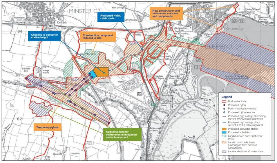
The changes to the Kent end of the project include an increase of the overall maximum height of the converter station, confirmation of the type of pylon to be used for the connection to the existing overhead line, and identifying a further construction and maintenance access route off Sandwich Road via the former hoverport.
National Grid is also proposing various other changes to construction and maintenance access routes, compounds, and temporary overhead line diversions, and has identified additional land for environmental mitigation and enhancement.
What has changed?
Permanent infrastructure HVDC cable route
Realigned high voltage direct current (HVDC) cable route near the A256 to avoid existing buried water infrastructure in this area. The use of trenchless crossing technology to reduce the impact of construction activity on road users.
Converter station height
Following more detailed design work after completing site surveys, National Grid is proposing to increase the ground level at the converter site around the converter station height by constructing a stone platform of up to two metres. The work may need to involve installing modular columns, which are underground concrete supports approximately 20 metres deep that help to spread the weight of buildings above, or by piling into the bedrock below. The approach taken will depend on ongoing and future detailed survey work.
The maximum height of the converter station buildings themselves would not change. However, as these structures would now be on a raised platform, the maximum total height will now be 28 metres rather than 26 metres.
Location and type of new pylons
Of the options consulted on previously, National Grid is confirming the use of full-height (approximately 50 metre) lattice pylons for the connection between the proposed combined converter station/substation and the Richborough to Canterbury 400 kV overhead line.
This means there would be fewer new pylons in total when compared to the low-height pylon option.
The location of the pylons now reduces the size of the triangular area that would be formed by the construction of pylons between the existing overhead line and the proposed substation. This aims to reduce the risk that birds could become trapped in between the new and existing overhead lines, but would result in an increase of approximately 1.2 km in the total length of new overhead line compared to original proposals at statutory consultation.
Further consultation
Between now and 11 August, consultees will be able to provide feedback on the changes, or on the proposals more generally, to the team via email or by Freepost.
A newsletter has been sent to around 36,000 addresses in the area with information on how to find out more about the alterations to the proposed project.
The project website is also updated and National Grid will be making paper copies of the consultation materials available at deposit points.
There will also be webinars and a series of parish council online briefings this month.
Archaeological surveys started yesterday (July 8) as part of an ongoing programme of technical and environmental assessments. The work will involve using a digger to remove the topsoil, usually around 30-60 centimetres deep, in trenches between 30 and 50 metres long.
Once the machines have removed the topsoil, archaeologists will photograph and take note of any archaeological features in the trench. Details can be found at nationalgrid.com/sealink.
Rethink Sea Link
Kent Wildlife Trust launched a campaign calling on the National Grid to “Rethink Sea Link” and avoid the proposed route which causes the most environmental impact.
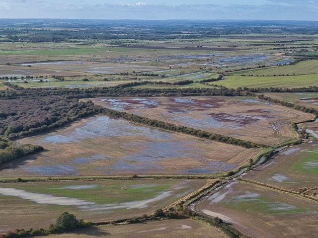
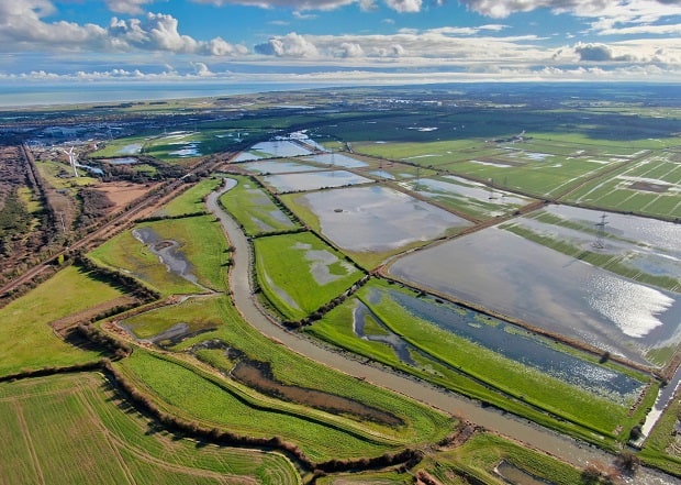
Conservationists and campaigners, such as the Save Minster Marshes group, are concerned the project will cause disturbance to wildlife at the internationally important National Nature Reserve Pegwell Bay and surrounding nature sites.
Join a webinar
A pre-recorded webinar is available to view on the project website (link above). It covers the latest changes to the Sea Link Project across Suffolk, Kent and offshore.
There will also be live webinars where the project team will present a brief overview of the proposals plus the latest changes to the plans.
Webinar on Tuesday 16 July, 6:30pm-7:45pm. Proposals in Kent and marine proposals
Monday 22 July, 6:30pm-7:45pm Proposals in Kent and marine proposals. Sign up to join via the web address above.
Paper copies
Paper copies of consultation material available at the following locations between Monday 8 July and Sunday 11 August at:
- Ash Library 11 Queen’s Rd, Ash, Canterbury
- Minster Library 4a Monkton Rd, Minster,
- Sandwich Library 13 Market St, Sandwich
- Ramsgate Library Guildford Lawn, Ramsgate
- Newington Library Royal Harbour Academy, Stirling Way, Ramsgate
- Margate Library Cecil Street, Margate,
Feedback – submit comments by 23:59 on 11 August.
Email: [email protected]
Write to: FREEPOST Sea Link
Timeline
The Sea Link project needs to obtain a development consent order (DCO) via an application to the Planning Inspectorate.
The development consent being sought will include a number of other provisions, including those which authorise the compulsory acquisition of land, and the compulsory acquisition of rights in, on or over land, if necessary, to construct, operate and maintain the proposed project.
The Secretary of State for Energy Security and Net Zero is expected to make a decision in 2025 with construction then taking place, if granted, between 2026 and 2030.
Campaign

A campaign page Save Minster Marshes has been set up by George Cooper on facebook for those who want to fight the proposals.
Find Save Minster Marshes here
Find the National Grid plans on its website here and on the Planning Inspectorate site here
