


Thanet councillors at a Cabinet meeting have agreed proposals to move forward with the publication of the isle’s Draft Local Plan, including amendments that mean Manston airport will no longer be designated for aviation use only.
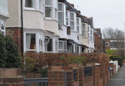
The Local Plan is a blueprint for housing, business and infrastructure for the isle up until 2031.
It sets out how much development is needed to support the future population and economy. Allocating land through the plan is designed to give the council greater control over where and what type of developments can take place.
Consultation was carried out earlier this year on revisions to the plan included axing the aviation-use only designation at Manston airport and putting forward two new isle sites at Manston Court Road and Haine Road.

The issue was debated at a Cabinet meeting last night (October 25) in front of a packed public gallery.
The plan provoked criticism from councillors of all parties who had joined the meeting.
‘Slit your wrists’
Ramsgate UKIP councillor and mayor Trevor Shonk questioned his own party’s U-turn on the election pledge to return aviation to the site, Cllr Suzanne Brimm said the decision led to the question of whether “to slit your wrists or your throat first” and both she and Cllr Rosanna Taylor-Smith criticised plans for a 6 week consultation saying it should be at least 8 weeks.
Conservative councillor Carol Partington raised the issue of transport and whether proper studies had been carried out for proposals for an inner ring road circuit and questioned housing numbers and the rate of delivery.
She also questioned why there was no Plan B for Manston when RiverOak Strategic Partners were due to submit a Development Consent Order to the Planning Inspectorate next month in a bid to reopen the airport as an air freight hub with passenger services and business aviation.
She added: “Ninety per cent of DCOs that reach the second stage get approved so why have we got no Plan B?”
Conservative Party leader at TDC, Bob Bayford, said the Tories would continue to fight for aviation at the site.
‘Rock and a hard place’

Heckling came from the public gallery as council leader Chris Wells responded.
Referring to RSPs plans for Manston, he said: “As a council we are caught between a rock and a hard place. Whatever preference there is for a particular site with a particular purpose it has to be put forward with evidence that stacks up and at the moment it does not stack up.”
The reports to be published are the pre-Submission draft plan, the Sustainability Appraisal and draft Transport Strategy, alongside other supporting documentation and the Thanet Landscape Character Assessment.
Following publication and consultation the draft Local Plan will be submitted to the Planning Inspectorate for Examination.
‘Significant risk’
Cll Fairbrass said if the draft plan was not submitted for examination by next March 31 there was “significant risk” that higher housing numbers would be imposed by Central Government.
Government guidelines currently dictate a build of 17,140 new isle homes by 2031.
But this level of housing may need to rise even further following a government proposal to standardise the way local authorities work out housing need.
New proposals could see that figure rise to more than 20,200 homes, raising the requirement from 857 dwellings per year to 1063 dwellings per year.
Some 1,555 homes have already been constructed; another 3,017 have been given planning permission; 2,700 are accounted for through windfall housing –sites that have historically had planning approval and may be put forward again – and 540 are already empty homes.
This leaves 9,328 properties to be accommodated.
Revised sites would provide 3,450 of these
Manston airport

Manston airport was designated for aviation only use in the last Local Plan – which expired in 2011 – but the independent viability report by Avia Solutions led to a decision to consult on the site being open for mixed use development to include homes and business space.
The report stated that airport operations at the site are “very unlikely to be financially viable in the longer term and almost certainly not possible in the period to 2031”.
The airport closed in May 2014 after Stagecoach bus bus Ann Gloag bought it for a nominal £1.
A campaign to reopen the site has followed.
RSP is now embarking on a Development Consent Order for the site through Central Government.
The land is owned by Stone Hill Park which submitted a planning application for 2,500 homes, a business park, sports and leisure facilities and parkland and open space.
The Local Plan revision states: “The site has the capacity to deliver at least 2,500 new dwellings and up to 85,000sqm employment and leisure floorspace.
“The overarching principle …is the creation of a single sustainable settlement that can be easily served by public transport and good, easily walkable access to central community services.”
Latest revisions
Retail
The retail need at Westwood has been revised down to 23,903sqm to the end of the plan period from 36,280sqm. Retail need for the main towns is revised down to 39,171sqm. This is due to a reduction in spending power in the “High Street.”
Business
Identifying a new site to accommodate advanced manufacturing and requiring the provision of community/business space on the strategic housing sites.
Green Spaces
A local green space will be afforded the same protection as Green Belts and new development will not be permitted other than in very special circumstances.
Recommended sites
Kitty’s Green, Broadstairs
Culmer’s amenity land, Broadstairs
Holmes Park Broadstairs
Land between Windermere and Kentmere Avenues, Ramsgate
Dane Valley Woods, Margate
Village Green, Foads Lane, Cliffsend
Meadow, Cliffs End Road, Cliffsend 8. Earlsmead Crescent, Cliffsend
Playground, Foads Lane, Cliffsend
Pierremont Park, Broadstairs
Memorial Ground, Lawn Road, Broadstairs
St Peter’s Recreation Ground, Broadstairs
Mockett’s Wood, Broadstairs
Westover Gardens, Broadstairs
Deletion
Gas Depot site in Northdown Road, St Peters to be removed from draft plan
Westwood Lodge to be removed from Green Wedge area
Additions
Land at Shottendane Farm, Shottendane Road, Margate (8 dwellings)
Site known as Lanthorne Court, Broadstairs (up to 56 dwellings)
56ha of employment land, meaning an addition of 8.5ha allocated at the Manston airport site
Transport
Changes are being suggested to infrastructure plans
Manston airport site
Details of how the RAF Manston Spitfire and Hurricane memorial Museum and RAF History Museum will be safeguarded to be added
Policies
A policy for the protection of allotments;
A Supplementary Planning Document (SPD) for the Westwood retail area, detailing pedestrian connectivity and the goal of transforming Westwood into a cohesive town centre;
Policy support for new education and health facilities at key locations in the district;
Continuing the policy from the adopted Local Plan to safeguard land for grow-on space for the QEQM hospital
Timetable
Debate at Overview and Scrutiny November 21
Back to Cabinet December 14
Debate at full council January
Publication of Submission version (full Local Plan) for a period of 6 weeks – mid-January 2018 (exact date tbc)
Submission to Planning Inspectorate – March 2018
Examination – June 2018..
The amended plan was approved by Cabinet members with just Cllr Rev Stuart Piper voting against..
